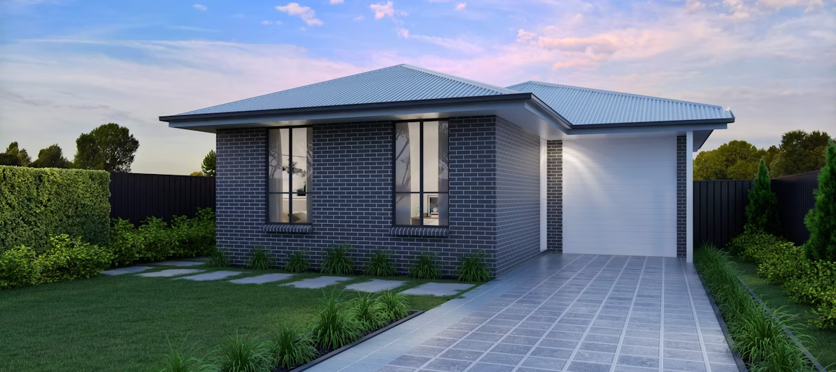

Lot 338 – Dunbar – Davoren Park
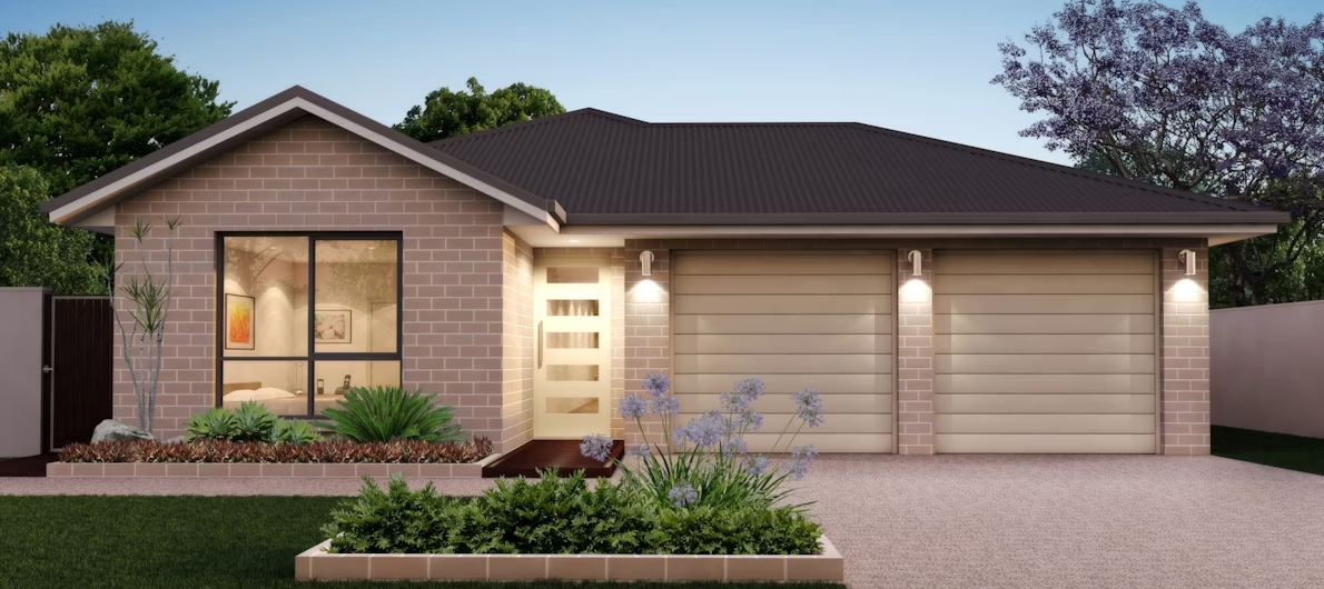
Property Basics
External ID:
684171
Lot #:
338
Property Type:
House and Land
Project Name:
Dunbar
Title Status:
Location
Suburb:
Davoren Park
City:
Adelaide
State:
SA
Postcode:
5113
Latitude:
-34.735066
Longitude:
138.708991
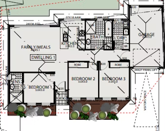
Layout
Land Size:
338sqm
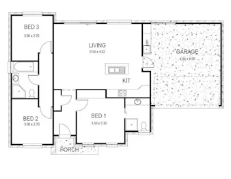
Property Size:
135sqm
Bedrooms:
3
Bathrooms:
2
Garages:
1
Financials
Price:
688064.00
Land Price:
Build Price:
Rent Yield
3.40%
Weekly Rent:
$450.00
*Please be advised that some lots/units may need confirmation of availability. Kindly ensure to check availability first by emailing or phoning us.*
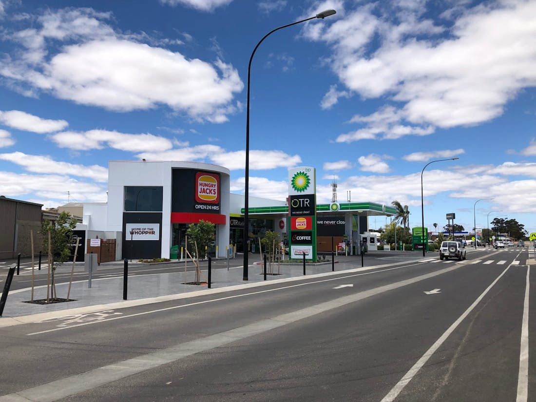
Davoren Park is a suburb located in the state of South Australia, Australia. It is situated in the northern suburbs of Adelaide, which is the state’s capital. Here’s an overview of Davoren Park:
Suburb Overview: Davoren Park is a residential suburb known for its suburban character, affordable housing options, and accessibility to various amenities. The suburb is situated in the northern suburbs of Adelaide and is part of the City of Playford.
Transportation: Davoren Park is well-connected to neighboring suburbs and the city of Adelaide. Major roads serving the suburb include Curtis Road, Peachey Road, and Stebonheath Road. Public transportation options include bus services operated by Adelaide Metro, making it convenient for residents to travel within Davoren Park and to other parts of Adelaide.
Schools: Davoren Park has several educational institutions catering to the local community. These include Davoren Park Primary School and Mark Oliphant College, which offer primary and secondary education options. Additionally, there are early learning centers and kindergartens in the area.
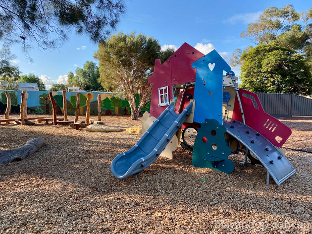
Parks and Recreational Areas: Davoren Park offers various parks, reserves, and recreational areas for residents to enjoy outdoor activities and leisure. Some popular parks include Davoren Park and Harford Park. These spaces provide open green areas, playgrounds, walking trails, and opportunities for outdoor activities.
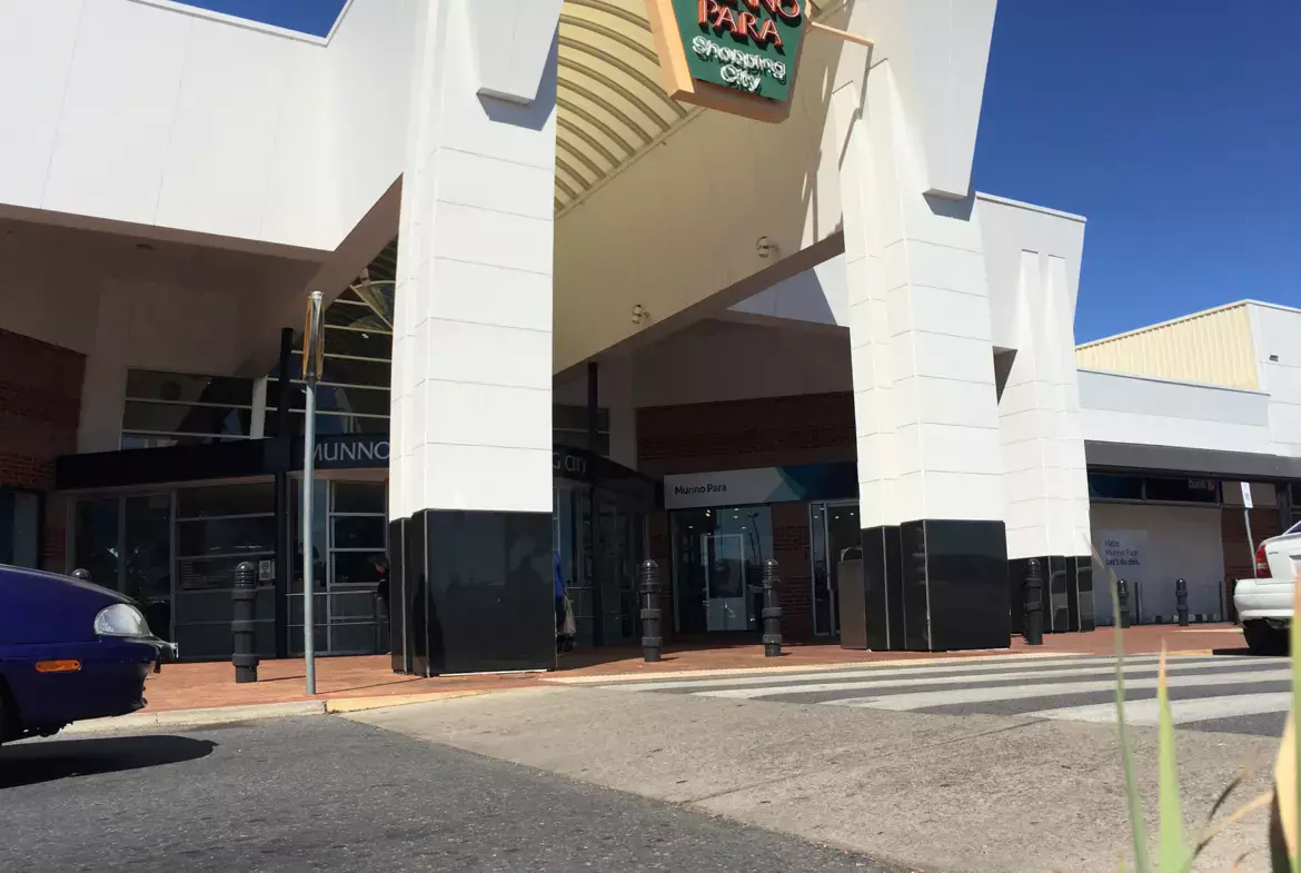
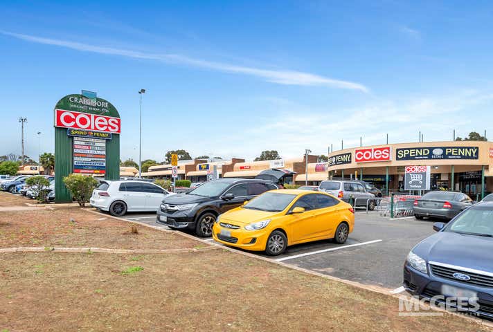
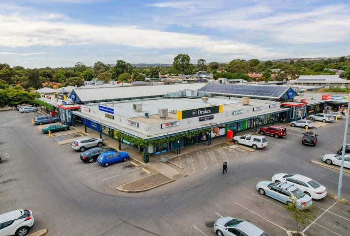
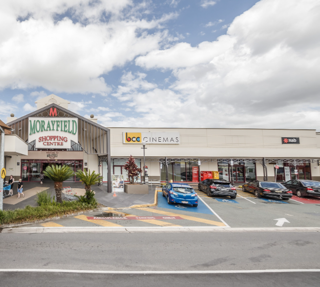
Shopping Centers: Davoren Park Shopping Centre is a local shopping complex in the suburb, featuring retail stores, convenience shops, dining options, and other services. For more extensive shopping experiences, residents can visit larger shopping centers in nearby suburbs.
Infrastructure: Davoren Park benefits from essential infrastructure to support its residents. The suburb has access to utilities, including electricity, water supply, and telecommunications services. Healthcare facilities, including medical centers and pharmacies, serve the local community’s healthcare needs. The road network is well-developed, ensuring convenient travel within the suburb and to other areas of Adelaide.
Davoren Park’s suburban atmosphere, affordable housing, and accessibility to amenities make it a practical place to live for many residents.
Lot 2 – Dayman Street – Elizabeth Park
Property Basics
External ID:
684164
Lot #:
2
Property Type:
House and Land
Project Name:
Dayman Street
Title Status:
Location
Suburb:
Elizabeth Park
City:
Adelaide
State:
SA
Postcode:
5113
Latitude:
-34.661066
Longitude:
138.634991
Layout
Land Size:
285sqm
Property Size:
122sqm
Bedrooms:
3
Bathrooms:
2
Garages:
1
Financials
Price:
640859.00
Land Price:
Build Price:
Rent Yield
3.73%
Weekly Rent:
$460.00
*Please be advised that some lots/units may need confirmation of availability. Kindly ensure to check availability first by emailing or phoning us.*
Elizabeth Park is a suburb located in the northern part of Adelaide, South Australia. It is part of the City of Playford and is situated approximately 25 kilometers north of Adelaide’s central business district. Here is an overview of Elizabeth Park:
Suburb Overview: Elizabeth Park is a predominantly residential area with a mix of housing options, including single-family homes and newer developments. It is a well-established suburb with various amenities that cater to families, retirees, and young professionals.
Transportation:
- Roads: Elizabeth Park is well-connected by major roads such as Main North Road and the Northern Expressway, making it easily accessible by car. These roads provide direct routes to Adelaide CBD and surrounding suburbs.
- Public Transport: The suburb is serviced by several bus routes operated by Adelaide Metro, which connect Elizabeth Park to nearby areas and major transport hubs. The Elizabeth railway station, located in the adjacent suburb of Elizabeth, offers train services on the Gawler Line, providing access to Adelaide CBD and Gawler.
Schools:
- Primary and Secondary Education: Elizabeth Park has several schools within and nearby the suburb, including Elizabeth Park Primary School, South Downs Primary School, and Playford College. Craigmore High School and other secondary schools are also located in the surrounding areas, offering educational options for families with school-aged children.
- Tertiary Education: While there are no tertiary institutions in Elizabeth Park itself, residents have access to nearby campuses such as TAFE SA Elizabeth campus and the University of South Australia’s Mawson Lakes campus.
Parks and Recreational Areas:
- Local Parks: Elizabeth Park features several parks and green spaces for outdoor activities. Notable parks include Fremont Park, which offers playgrounds, walking paths, and picnic areas, and Ridley Reserve, which has sports facilities and open spaces for recreation.
- Sports Facilities: The suburb and surrounding area have various sports facilities, including football, cricket, and soccer clubs, providing opportunities for residents to engage in physical activities and community sports.
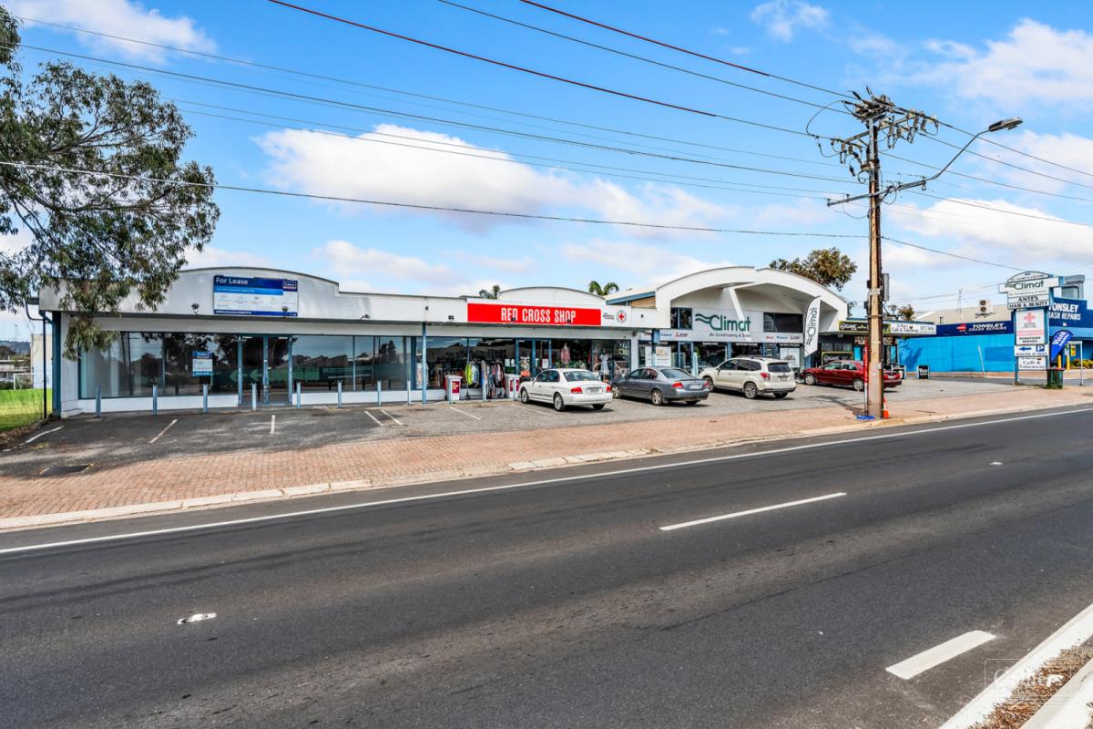
Shopping and Amenities:
- Local Shops: Elizabeth Park has a selection of local shops, cafes, and essential services. The Elizabeth Park Shopping Centre offers a range of retail options and conveniences for daily needs.
- Nearby Shopping Centers: For more extensive shopping, residents can visit the nearby Elizabeth City Centre, one of the largest shopping centers in the northern suburbs, featuring a wide variety of retail stores, supermarkets, dining options, and entertainment facilities.
Infrastructure:
- Healthcare: The suburb is serviced by local medical clinics, dental practices, and pharmacies. The nearby Lyell McEwin Hospital in Elizabeth Vale provides comprehensive healthcare services, including emergency care and specialist treatments.
- Community Services: Elizabeth Park benefits from various community services, including libraries, community centers, and support services. The City of Playford operates several community facilities that offer programs and activities for residents.
Community Services:
- Libraries and Community Centers: The Playford Library Service operates several branches, with the closest being in Elizabeth, providing book lending, internet access, and community programs. The Playford Civic Centre hosts events and activities for residents.
- Sports and Recreation Clubs: The suburb has several sports clubs and recreational facilities, including the Elizabeth Football Club and local cricket clubs, providing opportunities for physical activities and community engagement.
Events and Entertainment:
- Community Events: Elizabeth Park hosts various community events throughout the year, fostering a strong sense of community and engagement among residents. These events often include markets, festivals, and family-friendly activities.
- Cultural Events: Nearby venues and the Playford Civic Centre regularly host exhibitions, workshops, and cultural events, contributing to the vibrant community life in the region.
Lot 23A – Castle Road – Christies Beach
Property Basics
External ID:
684158
Lot #:
23A
Property Type:
House and Land
Project Name:
Castle Road
Title Status:
Location
Suburb:
Christies Beach
City:
Adelaide
State:
SA
Postcode:
5165
Latitude:
-35.089614
Longitude:
138.524683
Layout
Land Size:
412sqm
Property Size:
155sqm
Bedrooms:
3
Bathrooms:
2
Garages:
2
Financials
Price:
862870.00
Land Price:
Build Price:
Rent Yield
3.37%
Weekly Rent:
$560.00
*Please be advised that some lots/units may need confirmation of availability. Kindly ensure to check availability first by emailing or phoning us.*
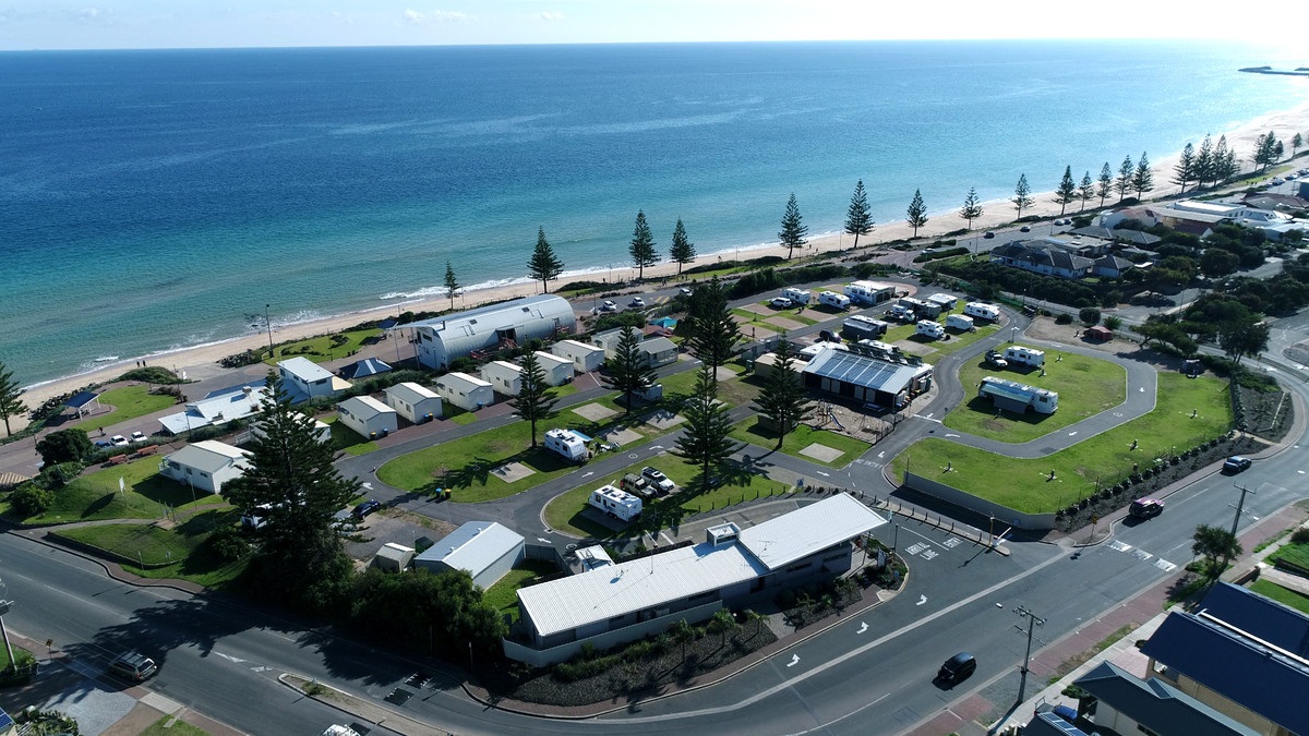
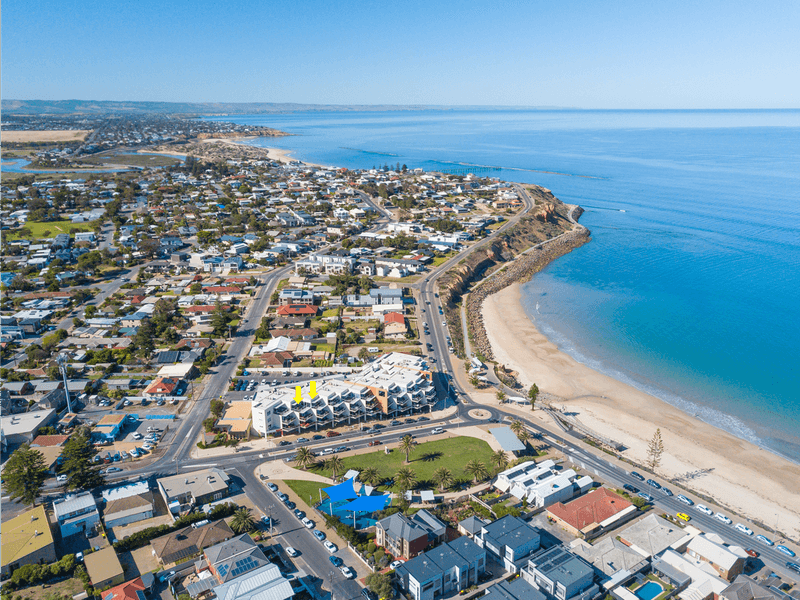
Christies Beach is a coastal suburb located in the southern suburbs of Adelaide, South Australia. Here’s a general overview:
Suburb Overview: Christies Beach is known for its coastal location, sandy beaches, and relaxed atmosphere. It is situated along the Gulf St Vincent and is part of the City of Onkaparinga.
Transportation: Christies Beach is accessible by road. Major roads in the area include the Esplanade and Dyson Road. Public transportation, including bus services, provides connectivity to nearby suburbs and the city center.
Beaches: The suburb is known for its sandy beaches, making it a popular destination for residents and visitors. Christies Beach itself offers a coastal environment for recreational activities and relaxation.
Schools: There are educational facilities in and around Christies Beach, including primary and secondary schools. Families in the area have access to various educational options.
Parks and Recreational Areas: Christies Beach provides parks and recreational spaces for outdoor activities. Beachside parks and reserves offer places for picnics and leisure.
Shopping: The suburb has local shops and businesses to meet residents’ daily needs. Additionally, larger shopping centers in nearby suburbs provide a broader range of retail options.
Infrastructure: Christies Beach has access to essential infrastructure, including utilities, healthcare facilities, and educational institutions. Medical centers and pharmacies serve the healthcare needs of residents.
Lot 23 – Castle Road – Christies Beach
Property Basics
External ID:
684157
Lot #:
23
Property Type:
House and Land
Project Name:
Castle Road
Title Status:
Location
Suburb:
Christies Beach
City:
Adelaide
State:
SA
Postcode:
5165
Latitude:
-35.169614
Longitude:
138.510683
Layout
Land Size:
325sqm
Property Size:
155sqm
Bedrooms:
3
Bathrooms:
2
Garages:
1
Financials
Price:
825800.00
Land Price:
Build Price:
Rent Yield
3.53%
Weekly Rent:
$560.00
*Please be advised that some lots/units may need confirmation of availability. Kindly ensure to check availability first by emailing or phoning us.*
Christies Beach is a coastal suburb located in the southern suburbs of Adelaide, South Australia. Here’s a general overview:
Suburb Overview: Christies Beach is known for its coastal location, sandy beaches, and relaxed atmosphere. It is situated along the Gulf St Vincent and is part of the City of Onkaparinga.
Transportation: Christies Beach is accessible by road. Major roads in the area include the Esplanade and Dyson Road. Public transportation, including bus services, provides connectivity to nearby suburbs and the city center.
Beaches: The suburb is known for its sandy beaches, making it a popular destination for residents and visitors. Christies Beach itself offers a coastal environment for recreational activities and relaxation.
Schools: There are educational facilities in and around Christies Beach, including primary and secondary schools. Families in the area have access to various educational options.
Parks and Recreational Areas: Christies Beach provides parks and recreational spaces for outdoor activities. Beachside parks and reserves offer places for picnics and leisure.
Shopping: The suburb has local shops and businesses to meet residents’ daily needs. Additionally, larger shopping centers in nearby suburbs provide a broader range of retail options.
Infrastructure: Christies Beach has access to essential infrastructure, including utilities, healthcare facilities, and educational institutions. Medical centers and pharmacies serve the healthcare needs of residents.
Lot 23 – Castle Road – Christies Beach
Property Basics
External ID:
684570
Lot #:
23
Property Type:
House and Land
Project Name:
Castle Road
Title Status:
Location
Suburb:
Christies Beach
City:
Adelaide
State:
SA
Postcode:
5165
Latitude:
-35.162614
Longitude:
138.503683
Layout
Land Size:
325sqm
Property Size:
155sqm
Bedrooms:
4
Bathrooms:
2
Garages:
1
Financials
Price:
865800.00
Land Price:
Build Price:
Rent Yield
3.78%
Weekly Rent:
$630.00
*Please be advised that some lots/units may need confirmation of availability. Kindly ensure to check availability first by emailing or phoning us.*
Christies Beach is a coastal suburb located in the southern suburbs of Adelaide, South Australia. Here’s a general overview:
Suburb Overview: Christies Beach is known for its coastal location, sandy beaches, and relaxed atmosphere. It is situated along the Gulf St Vincent and is part of the City of Onkaparinga.
Transportation: Christies Beach is accessible by road. Major roads in the area include the Esplanade and Dyson Road. Public transportation, including bus services, provides connectivity to nearby suburbs and the city center.
Beaches: The suburb is known for its sandy beaches, making it a popular destination for residents and visitors. Christies Beach itself offers a coastal environment for recreational activities and relaxation.
Schools: There are educational facilities in and around Christies Beach, including primary and secondary schools. Families in the area have access to various educational options.
Parks and Recreational Areas: Christies Beach provides parks and recreational spaces for outdoor activities. Beachside parks and reserves offer places for picnics and leisure.
Shopping: The suburb has local shops and businesses to meet residents’ daily needs. Additionally, larger shopping centers in nearby suburbs provide a broader range of retail options.
Infrastructure: Christies Beach has access to essential infrastructure, including utilities, healthcare facilities, and educational institutions. Medical centers and pharmacies serve the healthcare needs of residents.

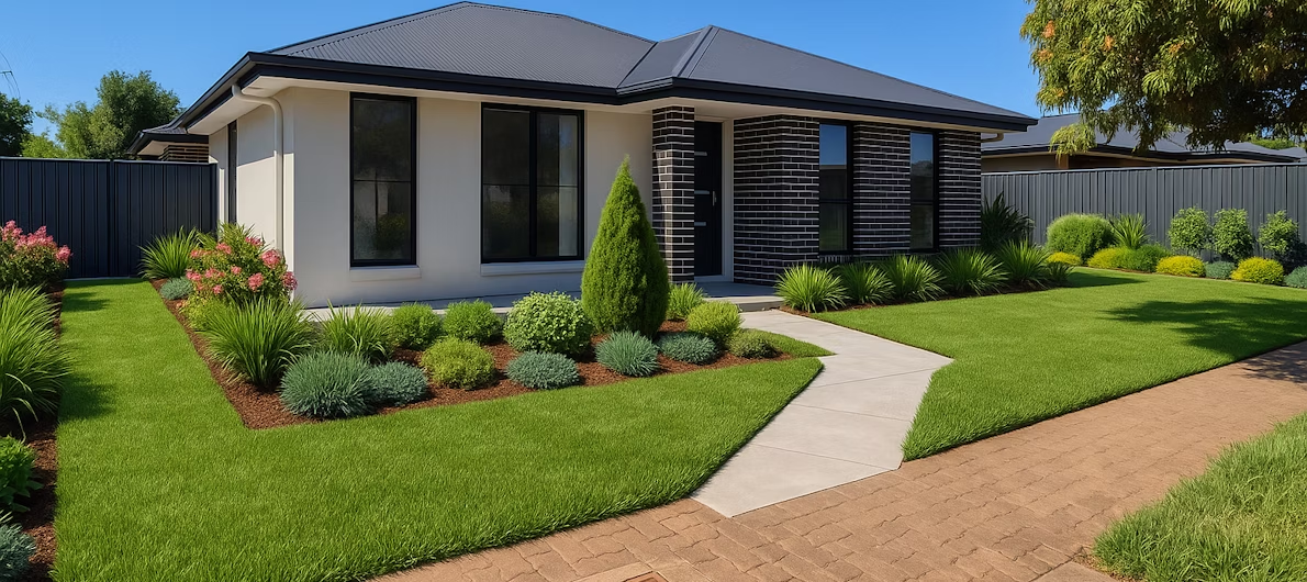
Lot 34 – St Marys Street – St Marys
Property Basics
External ID:
684143
Lot #:
34
Property Type:
House and Land
Project Name:
St Marys Street
Title Status:
Location
Suburb:
St Marys
City:
Adelaide
State:
SA
Postcode:
5042
Latitude:
-34.970377
Longitude:
138.535556
Layout
Land Size:
365.5sqm
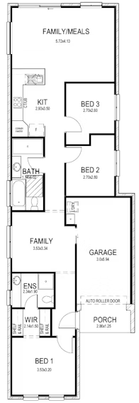
Property Size:
176sqm
Bedrooms:
3
Bathrooms:
2
Garages:
1
Financials
Price:
981800.00
Land Price:
Build Price:
Rent Yield
3.27%
Weekly Rent:
$617.00
*Please be advised that some lots/units may need confirmation of availability. Kindly ensure to check availability first by emailing or phoning us.*
St Marys, located about 8 kilometres south of Adelaide’s CBD, is a well-positioned and established suburb within the City of Mitcham. It offers a convenient and comfortable suburban lifestyle with easy access to major shopping centres, schools, and public transport, while maintaining a quiet, family-friendly atmosphere. The suburb features a mix of older character homes, post-war houses, and newer developments, making it appealing to a wide range of residents, including young families, professionals, and retirees.
Local amenities in St Marys are practical and community-focused. The suburb is home to several parks and reserves such as Shepherds Hill Recreation Park and St Marys Park, offering open spaces for walking, sports, and outdoor activities. The Mitcham Community Centre and nearby libraries and fitness facilities provide spaces for learning and recreation. Medical centres, local cafes, and small businesses are also scattered throughout the area, ensuring daily convenience.
Shopping options are excellent, with the large Westfield Marion Shopping Centre only a short drive away. This major retail hub features supermarkets, department stores, restaurants, cinemas, and specialty shops. Smaller shopping strips along South Road and surrounding suburbs such as Pasadena and Melrose Park offer additional local options for groceries and dining.
Education in and around St Marys is well catered for, making it attractive to families. The suburb is close to quality schools such as St Bernadette’s School, Clovelly Park Primary School, and Pasadena High School. Several childcare centres and kindergartens operate nearby, and Flinders University—one of South Australia’s leading tertiary institutions—is only about 10 minutes away, adding further educational convenience.
Transportation in St Marys is another key advantage. The suburb sits along South Road, one of Adelaide’s major arterial routes, providing direct access to the CBD and the southern suburbs. The Tonsley railway station and nearby bus routes connect residents easily to the city and other parts of Adelaide, while the Southern Expressway ensures smooth travel toward coastal and outer southern areas.
Overall, St Marys offers a balanced and connected lifestyle with all the essentials close at hand. Its blend of accessibility, education options, and suburban comfort makes it an appealing place to live for families and commuters who value proximity to both the city and the coast while enjoying a peaceful neighbourhood environment.
Lot 34 – St Marys Street – St Marys
Property Basics
External ID:
684142
Lot #:
34
Property Type:
House and Land
Project Name:
St Marys Street
Title Status:
Location
Suburb:
St Marys
City:
Adelaide
State:
SA
Postcode:
5042
Latitude:
-35.051377
Longitude:
138.524556
Layout
Land Size:
365.5sqm
Property Size:
176sqm
Bedrooms:
3
Bathrooms:
2
Garages:
1
Financials
Price:
914064.00
Land Price:
Build Price:
Rent Yield
3.51%
Weekly Rent:
$617.00
*Please be advised that some lots/units may need confirmation of availability. Kindly ensure to check availability first by emailing or phoning us.*
St Marys, located about 8 kilometres south of Adelaide’s CBD, is a well-positioned and established suburb within the City of Mitcham. It offers a convenient and comfortable suburban lifestyle with easy access to major shopping centres, schools, and public transport, while maintaining a quiet, family-friendly atmosphere. The suburb features a mix of older character homes, post-war houses, and newer developments, making it appealing to a wide range of residents, including young families, professionals, and retirees.
Local amenities in St Marys are practical and community-focused. The suburb is home to several parks and reserves such as Shepherds Hill Recreation Park and St Marys Park, offering open spaces for walking, sports, and outdoor activities. The Mitcham Community Centre and nearby libraries and fitness facilities provide spaces for learning and recreation. Medical centres, local cafes, and small businesses are also scattered throughout the area, ensuring daily convenience.
Shopping options are excellent, with the large Westfield Marion Shopping Centre only a short drive away. This major retail hub features supermarkets, department stores, restaurants, cinemas, and specialty shops. Smaller shopping strips along South Road and surrounding suburbs such as Pasadena and Melrose Park offer additional local options for groceries and dining.
Education in and around St Marys is well catered for, making it attractive to families. The suburb is close to quality schools such as St Bernadette’s School, Clovelly Park Primary School, and Pasadena High School. Several childcare centres and kindergartens operate nearby, and Flinders University—one of South Australia’s leading tertiary institutions—is only about 10 minutes away, adding further educational convenience.
Transportation in St Marys is another key advantage. The suburb sits along South Road, one of Adelaide’s major arterial routes, providing direct access to the CBD and the southern suburbs. The Tonsley railway station and nearby bus routes connect residents easily to the city and other parts of Adelaide, while the Southern Expressway ensures smooth travel toward coastal and outer southern areas.
Overall, St Marys offers a balanced and connected lifestyle with all the essentials close at hand. Its blend of accessibility, education options, and suburban comfort makes it an appealing place to live for families and commuters who value proximity to both the city and the coast while enjoying a peaceful neighbourhood environment.
Lot 2846 – Central Springs – Caboolture
Property Basics
External ID:
684137
Lot #:
2846
Property Type:
House and Land
Project Name:
Central Springs
Title Status:
Location
Suburb:
Caboolture
City:
Moreton Bay
State:
QLD
Postcode:
4510
Latitude:
-27.086344
Longitude:
152.938116
Layout
Land Size:
489sqm
Property Size:
200sqm
Bedrooms:
4
Bathrooms:
2
Garages:
2
Financials
Price:
1000640.00
Land Price:
Build Price:
Rent Yield
3.22%
Weekly Rent:
$620.00
*Please be advised that some lots/units may need confirmation of availability. Kindly ensure to check availability first by emailing or phoning us.*
Caboolture is a rapidly growing suburb in the Moreton Bay region of Queensland, Australia. Situated approximately 44 kilometers north of Brisbane, Caboolture serves as a regional transport hub with significant historical and contemporary importance.
Caboolture boasts a range of amenities, including several schools, a public library, and health services. The area is set to benefit from major infrastructure projects, such as the proposed alternative transport route to the Bruce Highway, which will improve connectivity between Brisbane and the Sunshine Coast. This development aligns with the State Government’s South East Queensland Regional Plan, which aims to support the region’s growing population by enhancing transportation and public services
The community in Caboolture is diverse, with a mix of young families, professionals, and retirees. The suburb offers a variety of recreational options, including parks, cultural venues, and local markets. The Caboolture Historical Village is a popular attraction, showcasing the area’s history through a collection of heritage buildings and artifacts.
Caboolture is a dynamic suburb with a rich history, robust property market, and growing infrastructure, making it an attractive place for both residents and investors.
Lot 2504 – Central Springs – Caboolture
Property Basics
External ID:
684136
Lot #:
2504
Property Type:
House and Land
Project Name:
Central Springs
Title Status:
Location
Suburb:
Caboolture
City:
Moreton Bay
State:
QLD
Postcode:
4510
Latitude:
-27.101344
Longitude:
153.005116
Layout
Land Size:
451sqm
Property Size:
200sqm
Bedrooms:
4
Bathrooms:
2
Garages:
2
Financials
Price:
967270.00
Land Price:
Build Price:
Rent Yield
3.33%
Weekly Rent:
$620.00
*Please be advised that some lots/units may need confirmation of availability. Kindly ensure to check availability first by emailing or phoning us.*
Caboolture is a rapidly growing suburb in the Moreton Bay region of Queensland, Australia. Situated approximately 44 kilometers north of Brisbane, Caboolture serves as a regional transport hub with significant historical and contemporary importance.
Caboolture boasts a range of amenities, including several schools, a public library, and health services. The area is set to benefit from major infrastructure projects, such as the proposed alternative transport route to the Bruce Highway, which will improve connectivity between Brisbane and the Sunshine Coast. This development aligns with the State Government’s South East Queensland Regional Plan, which aims to support the region’s growing population by enhancing transportation and public services
The community in Caboolture is diverse, with a mix of young families, professionals, and retirees. The suburb offers a variety of recreational options, including parks, cultural venues, and local markets. The Caboolture Historical Village is a popular attraction, showcasing the area’s history through a collection of heritage buildings and artifacts.
Caboolture is a dynamic suburb with a rich history, robust property market, and growing infrastructure, making it an attractive place for both residents and investors.
Lot 2505 – Central Springs – Caboolture
Property Basics
External ID:
684135
Lot #:
2505
Property Type:
House and Land
Project Name:
Central Springs
Title Status:
Location
Suburb:
Caboolture
City:
Moreton Bay
State:
QLD
Postcode:
4510
Latitude:
-27.020344
Longitude:
153.004116
Layout
Land Size:
492sqm
Property Size:
200sqm
Bedrooms:
4
Bathrooms:
2
Garages:
2
Financials
Price:
989300.00
Land Price:
Build Price:
Rent Yield
3.26%
Weekly Rent:
$620.00
*Please be advised that some lots/units may need confirmation of availability. Kindly ensure to check availability first by emailing or phoning us.*
Caboolture is a rapidly growing suburb in the Moreton Bay region of Queensland, Australia. Situated approximately 44 kilometers north of Brisbane, Caboolture serves as a regional transport hub with significant historical and contemporary importance.
Caboolture boasts a range of amenities, including several schools, a public library, and health services. The area is set to benefit from major infrastructure projects, such as the proposed alternative transport route to the Bruce Highway, which will improve connectivity between Brisbane and the Sunshine Coast. This development aligns with the State Government’s South East Queensland Regional Plan, which aims to support the region’s growing population by enhancing transportation and public services
The community in Caboolture is diverse, with a mix of young families, professionals, and retirees. The suburb offers a variety of recreational options, including parks, cultural venues, and local markets. The Caboolture Historical Village is a popular attraction, showcasing the area’s history through a collection of heritage buildings and artifacts.
Caboolture is a dynamic suburb with a rich history, robust property market, and growing infrastructure, making it an attractive place for both residents and investors.
Search… e.g Brisbane 4005
SUBMIT